4. Import Grids from Files
This option allows user to import an existing grid file. Grid file formats that are supported include:
- CVLGrid: DSI’s curvilinear orthogonal grid generator - CVL Grid information
- RGFGrid: Deltares grid generator
- Grid95: @todo check on EEMS website
- DXDY/LYLY: EFDC+ grid descriptors
- ECOMSED:
- SEAGRID: @todo add link to download page
- CH3D: Army Corp of Engineers model
- Corners: file containing coordinates of four corners of each cell
The user should click the Import Grids radial button, and the Import Grid form will be displayed. From here the user should select the grid type from the drop-down list of Grid types as shown in Figure 12, then click the Browse button to browse to the grid file, and click OK.
In the case that there are a number of sub-grids for a water body, the Multiple grid files option needs to be checked, then the user may browse to the folder containing the grid files. To select multiple grid files at same time, hold the Ctrl key and select the grid files then click the OK button to load grid files (see Figure 13 and Figure 14).
Save the EFDC model in the same way described in section Generate Uniform Grid.
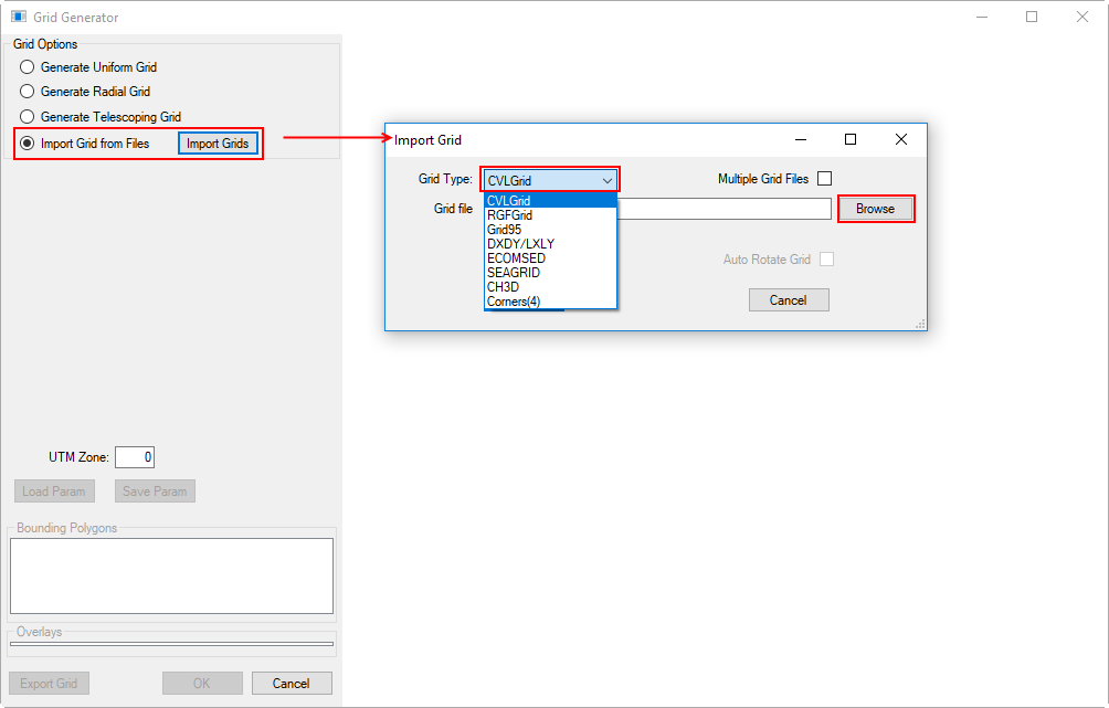
Figure 12 Import from a grid file.
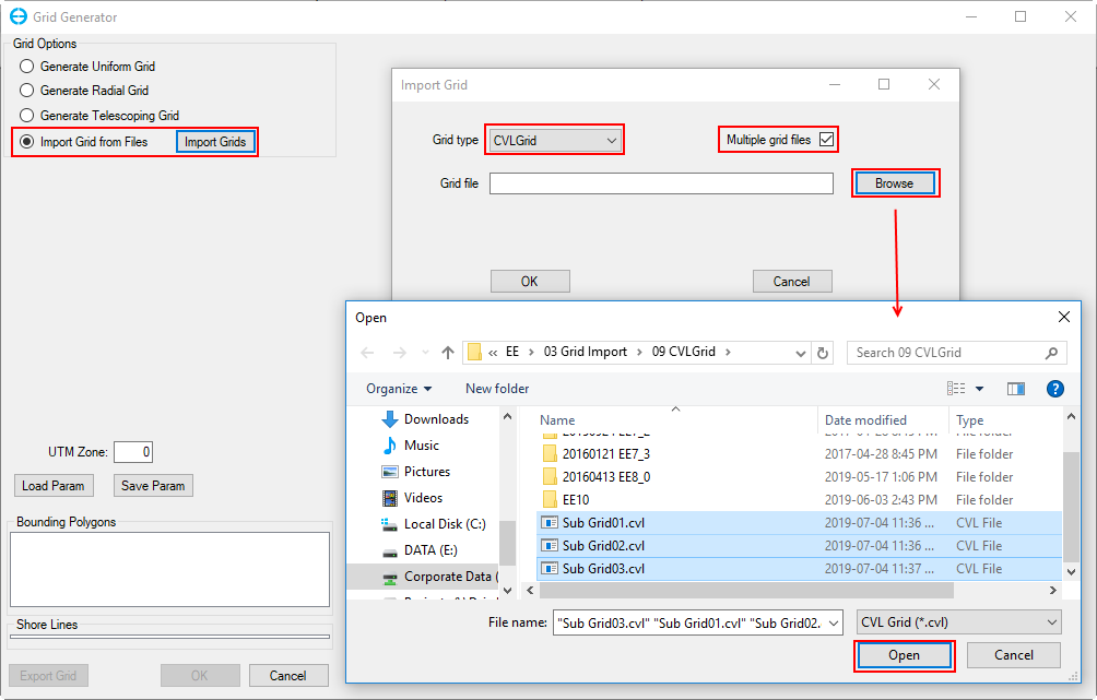
Figure 13. Import from multiple grid files – file selection.
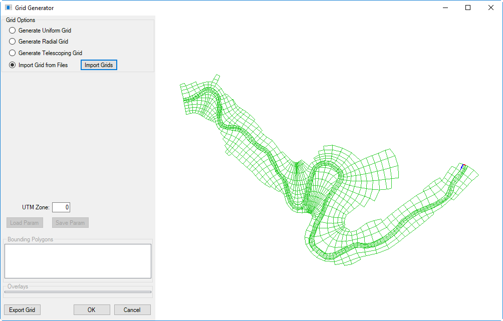
Figure 14. Import from multiple grid files – result display.
Note that the user should update the UTM Zone to the correct value before clicking the OK button to generate a new model. The UTM Zone is not used for model computation but it is important for coordinate conversion, exporting to GIS formats, and writing NetCDF outputs.